- Starting Point
- Type of Trail
- Distance
- Duration
- Afur
- Circular
- 15 Km
- 7 H
- Ending Point
- Dificulty
- Elevation
- Afur
- Hard
- 1059 m
Route Highlights
-
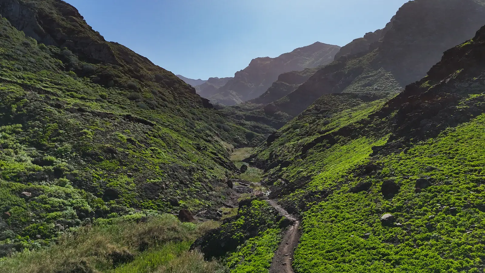
Barranco de Afur – deep ravine with running water, cave houses, and native plants
-
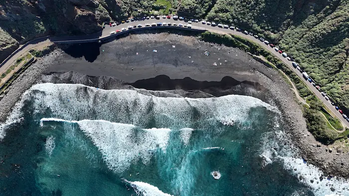
Playa de Tamadite – remote volcanic beach surrounded by cliffs (not safe for swimming)
-
El Chorro (Los Auchones) – quiet hamlet with vineyards, old wine presses, and traditional farming
-
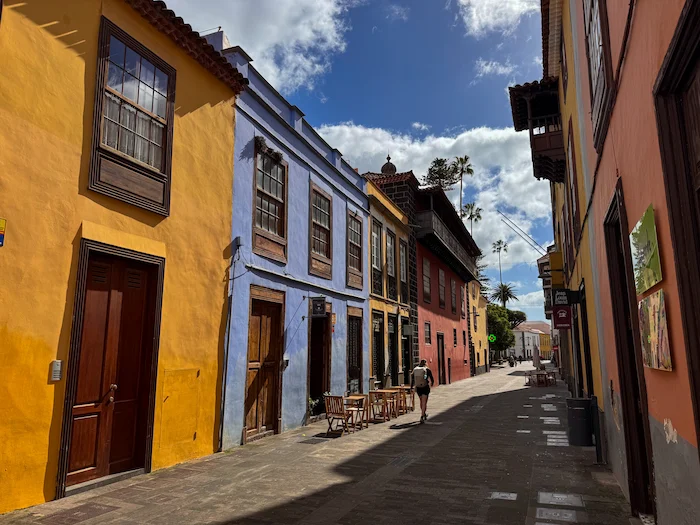
Taganana village – historic settlement with Canarian architecture and local wine culture
-
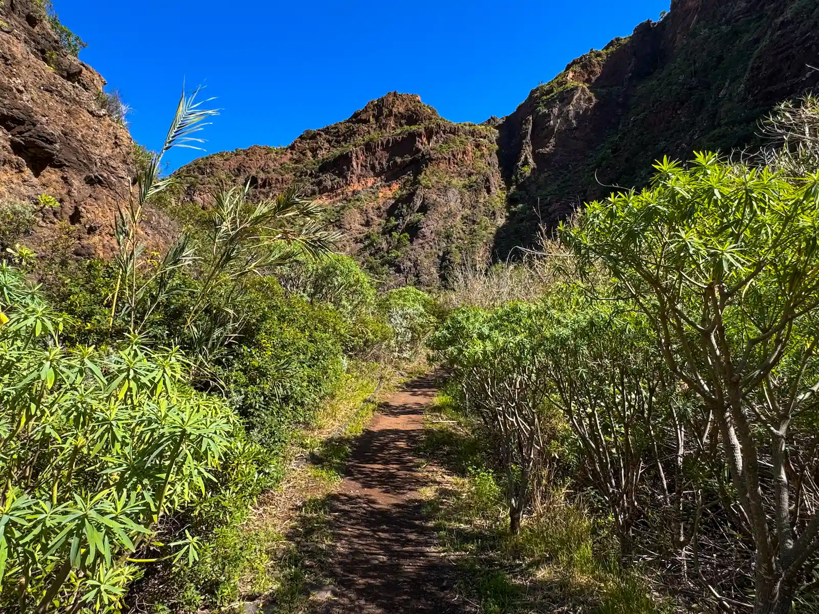
Monte de las Vueltas – shady forest trail through laurel and heather woods
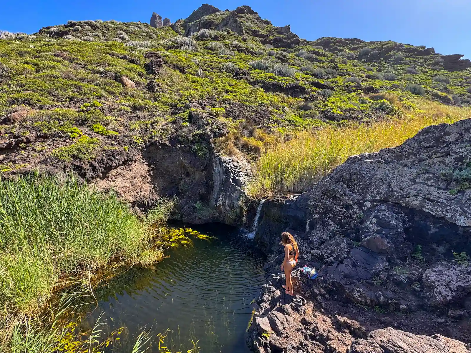
- Frogs and birds in water pools along the ravine

Information
This circular 14 km trail begins and ends in the quiet village of Afur, located in Anaga Rural Park. It’s ademanding route with steep climbs and narrow paths, only recommended for experienced hikers. The path descends through Barranco de Afur to the wild Playa de Tamadite, then climbs to Taganana, before returning through the shady Monte de las Vueltas.
Expect a full day out (approx. 7 hours), with changing landscapes: deep ravines, volcanic beaches, remote hamlets, and laurel forests. Some sections may be slippery or exposed, especially after rain.
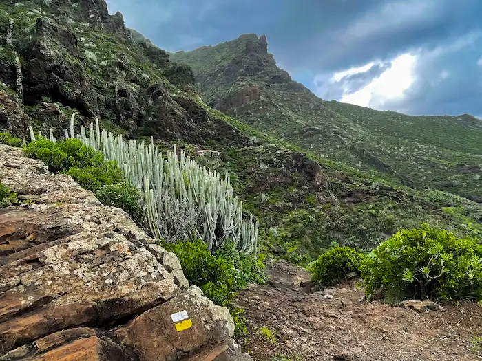
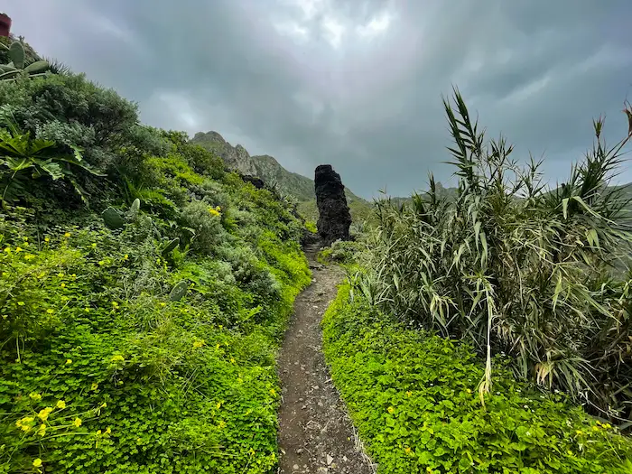
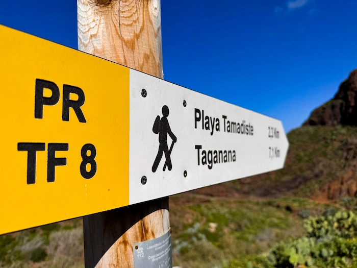
The hike starts from the small plaza in Afur, near the San Pedro chapel, following trail PR-TF 8. The first part crosses the Barranco de Afur, with running water during wetter months, and native plants like tabaibas and cardones lining the route.
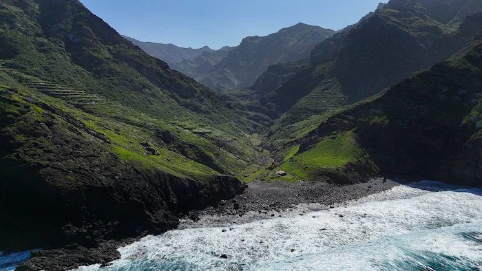
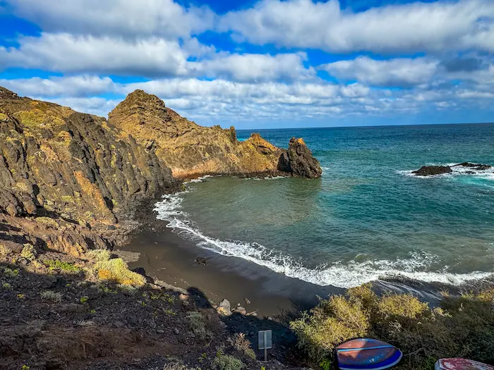
After around 1 hour, you reach Playa de Tamadite, a wild beach with dark volcanic sand and big rocks. It’s not safe for swimming due to strong currents. This is a good spot for a short rest.
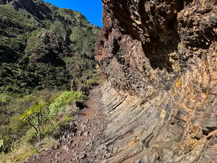
From the beach, the steepest climb begins. The trail leads to El Chorro (Los Auchones), a quiet hamlet with vineyards and old stone wine presses. Continue uphill until you reach Taganana, one of the oldest settlements in Tenerife. If you have time, you can explore the church or grab food here — but keep in mind you still have half the route ahead.
The return goes through Monte de las Vueltas, a lush forest area with sections of laurisilva, tree heather, and ferns. You’ll pass a few houses and reach the Camino de Enchirés, which takes you back to Afur. The final stretch includes a climb up to the Degollada de la Cumbrilla, then a descent on cement tracks to the starting point.
How to Get Here
-
By car: From La Laguna, take TF-12 towards Las Mercedes. Then follow signs for Afur via TF-136. Road is narrow and winding. Parking is available next to the San Pedro chapel in Afur (limited spaces).
-
By bus: From Intercambiador La Laguna, take TITSA bus 076 to Afur. Same line for the return. Check the schedule in advance — it’s infrequent.
Discover Places Nearby


All the best places in one map – beaches, hikes, food, ocean pools, viewpoints, towns and more.
Save hours of searching and plan your trip in minutes.
