
- Starting Point
- Type of Trail
- Distance
- Duration
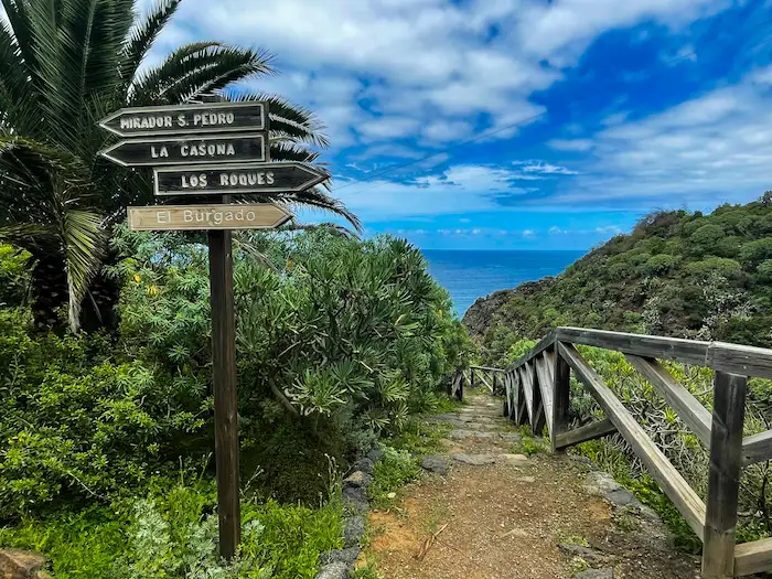
- Mirador Los Roques
- Linear
- 4 Km
- 1.50 H
- Ending Point
- Dificulty
- Elevation
- Mirador San Pedro
- Easy
- 227 m
Route Highlights
-
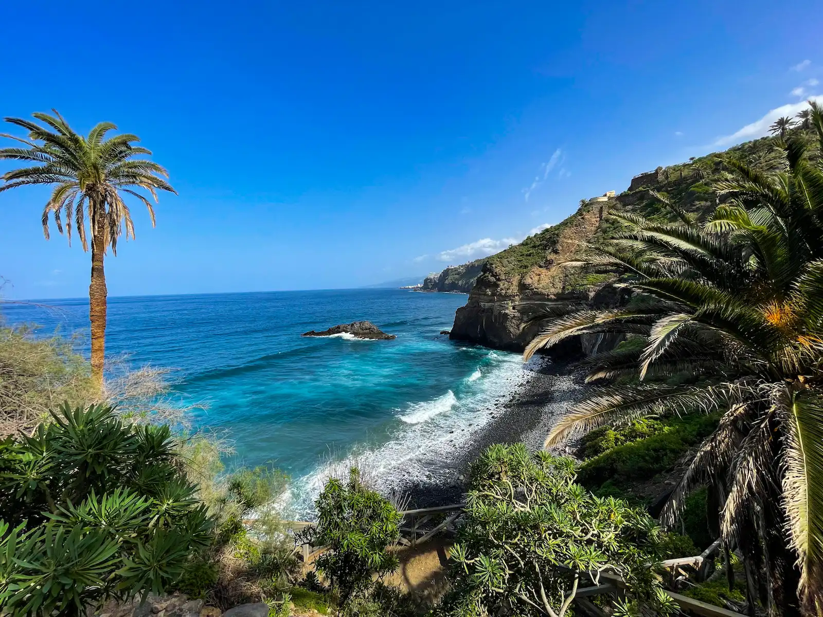
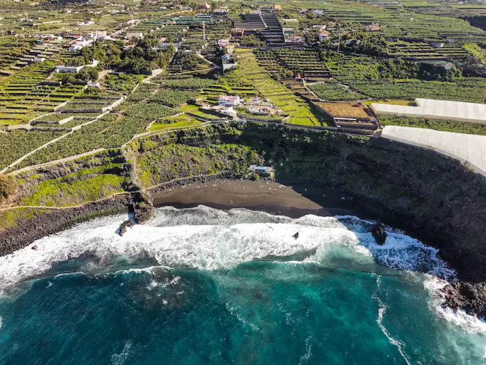
El Burgado Viewpoint: Starting point with panoramic views over Playa de Los Roques and volcanic formations.
-
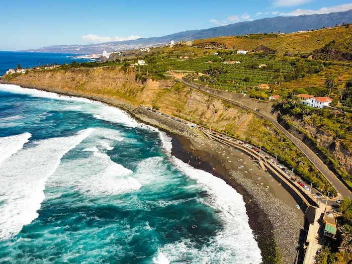
Playa de Los Roques: Dramatic beach with black sand and volcanic rock formations.
-
La Casona de los Castro: A historic 16th-century estate surrounded by rare native vegetation.
-
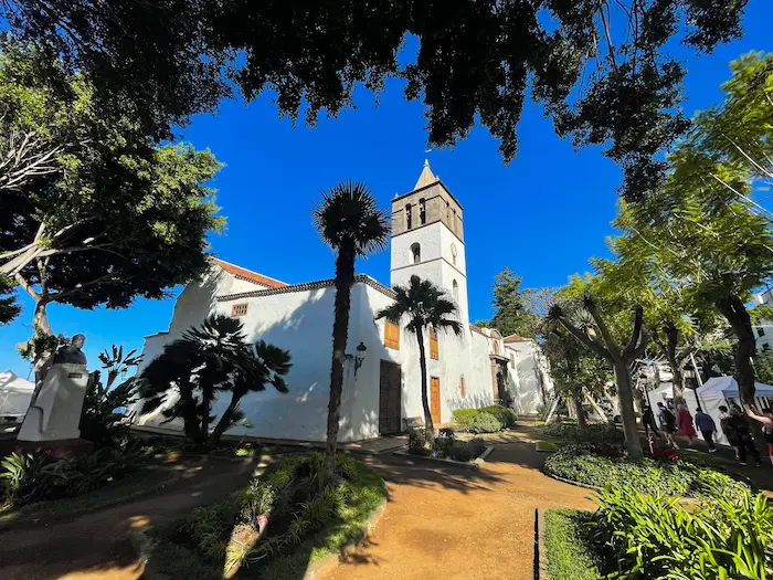
San Pedro Chapel: One of the oldest chapels in northern Tenerife (early 16th century).
-
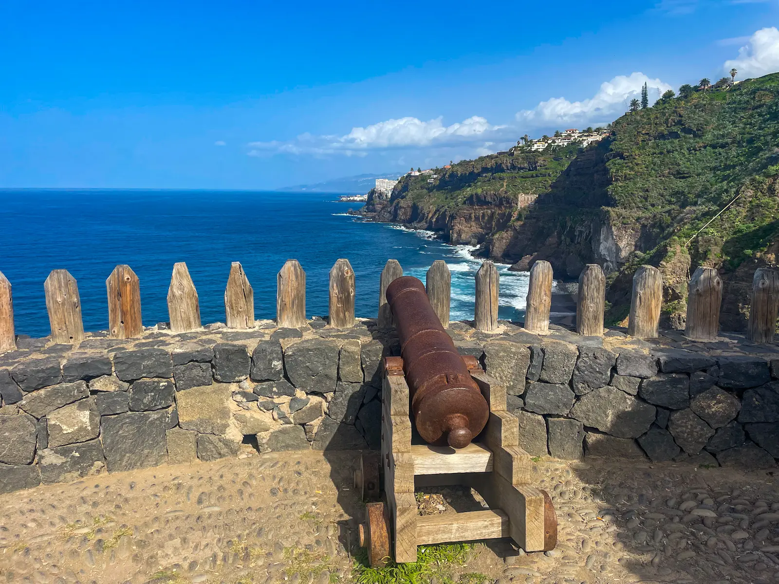
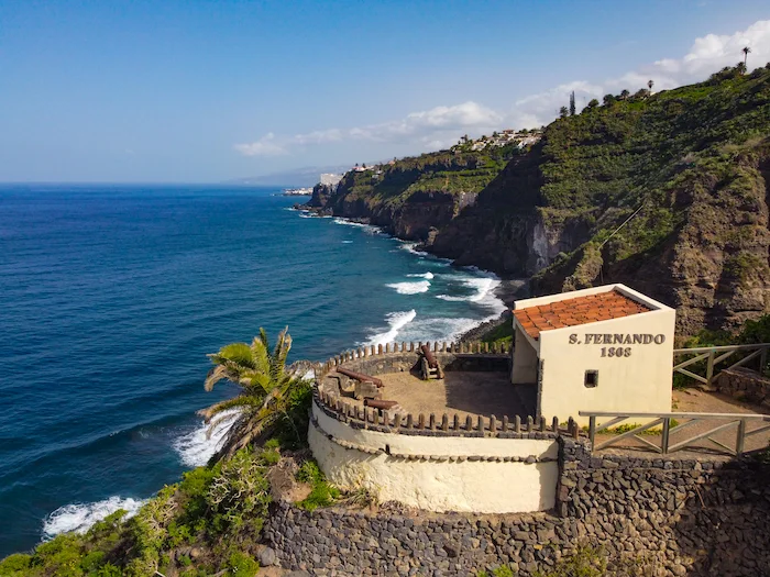
San Fernando Fort: 18th-century defensive fort built against pirate attacks.
-
Elevador de Aguas de La Gordejuela: Ruins of the first steam-powered water elevator in Tenerife.
-
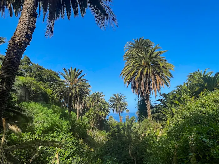
Hacienda de Castro: Remains of an old agricultural estate, now surrounded by one of the last palm groves in the north of the island.
-
Spectacular Coastline: Uninterrupted views of cliffs, wild beaches, and banana plantations.

Information
The Rambla de Castro coastal trail is one of Tenerife’s hidden gems.
This protected natural landscape combines lush vegetation, volcanic scenery, and rich history, offering hikers a unique experience where the green of the palm groves merges with the blue of the Atlantic Ocean.
Ideal for nature lovers, photographers, and travelers looking to explore Tenerife beyond the tourist hotspots.
The trail is well-marked and accessible year-round, with cobblestone paths, dirt tracks, and easy traditional footpaths.
Starting at the Mirador San Pedro, from there, simply follow the marked path as you descend towards the coast. You’ll pass by the San Pedro Chapel, a small 16th-century religious building.
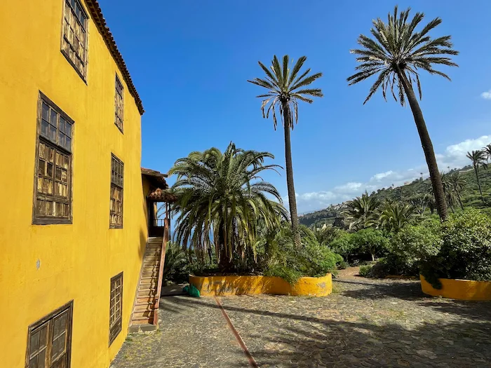
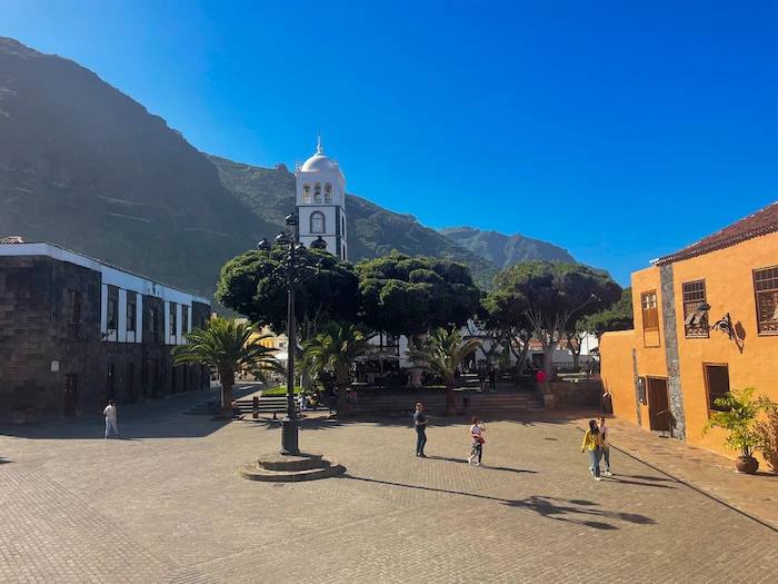
Shortly after, you’ll reach La Casona de los Castro, a historic yellow estate built after the conquest of Tenerife by the Portuguese merchant Hernando de Castro. Surrounded by lush gardens and rare Canarian palm trees, it once symbolised the island’s agricultural wealth.
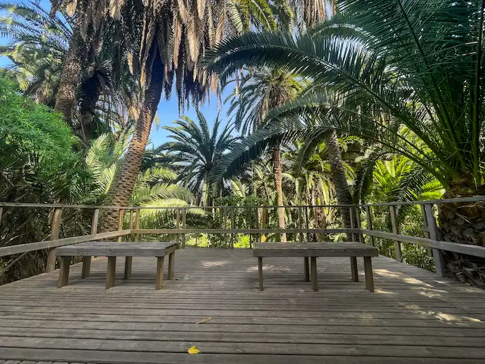
Continuing along the trail, you’ll walk through one of the best-preserved palm groves on the island, part of a unique ecosystem filled with native species like cardón (Euphorbia) and drago trees.
Hidden among the greenery, you’ll encounter the San Fernando Fort, built in 1808 to defend the coast from pirate attacks. Three of the original five cannons still remain today.
Further along, the trail reveals one of the most fascinating historical landmarks: the Elevador de Aguas de La Gordejuela.
Built in 1905 by the Hamilton company, this structure was Tenerife’s first steam-powered water elevator, raising water from coastal springs up to the La Orotava valley for agricultural use. Today, its crumbling ruins perched above the ocean create one of the most iconic sights on the trail.
The hike continues for a few hundred meters along the coast beyond its official end, but it can extend all the way to the Mirador El Burgado viewpoint. There you’ll find the rocky Playa de los Roques with striking volcanic formations shaped by centuries of erosion.
How to Get Here
By Car: You can park near the Mirador San Pedro or Park Here.
From the parking, walk to the viewpoint to enjoy the scenery, then continue a few minutes through the residential area to join the official trail at coordinates 28.401354, -16.580541.
By Bus: TITSA bus 381 towards Icod de los Vinos. Get off at the La Dehesa and from the bus stop, walk about 10 minutes to Mirador Playa Los Roques.
Discover Places Nearby


All the best places in one map – beaches, hikes, food, ocean pools, viewpoints, towns and more.
Save hours of searching and plan your trip in minutes.
