- Starting Point
- Type of Trail
- Distance
- Duration
- Santiago del Teide
- Linear
- 8 Km
- 4 H
- Ending Point
- Dificulty
- Elevation
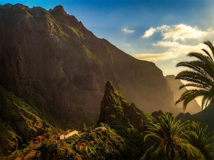
- Masca Village
- Moderate
- 574 m
Route Highlights
-
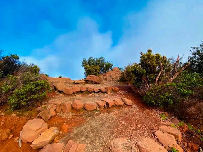
Degollada de la Mesa – A wide mountain pass at 1247 meters. From here, the landscapes open up towards the rugged Teno massif.
-
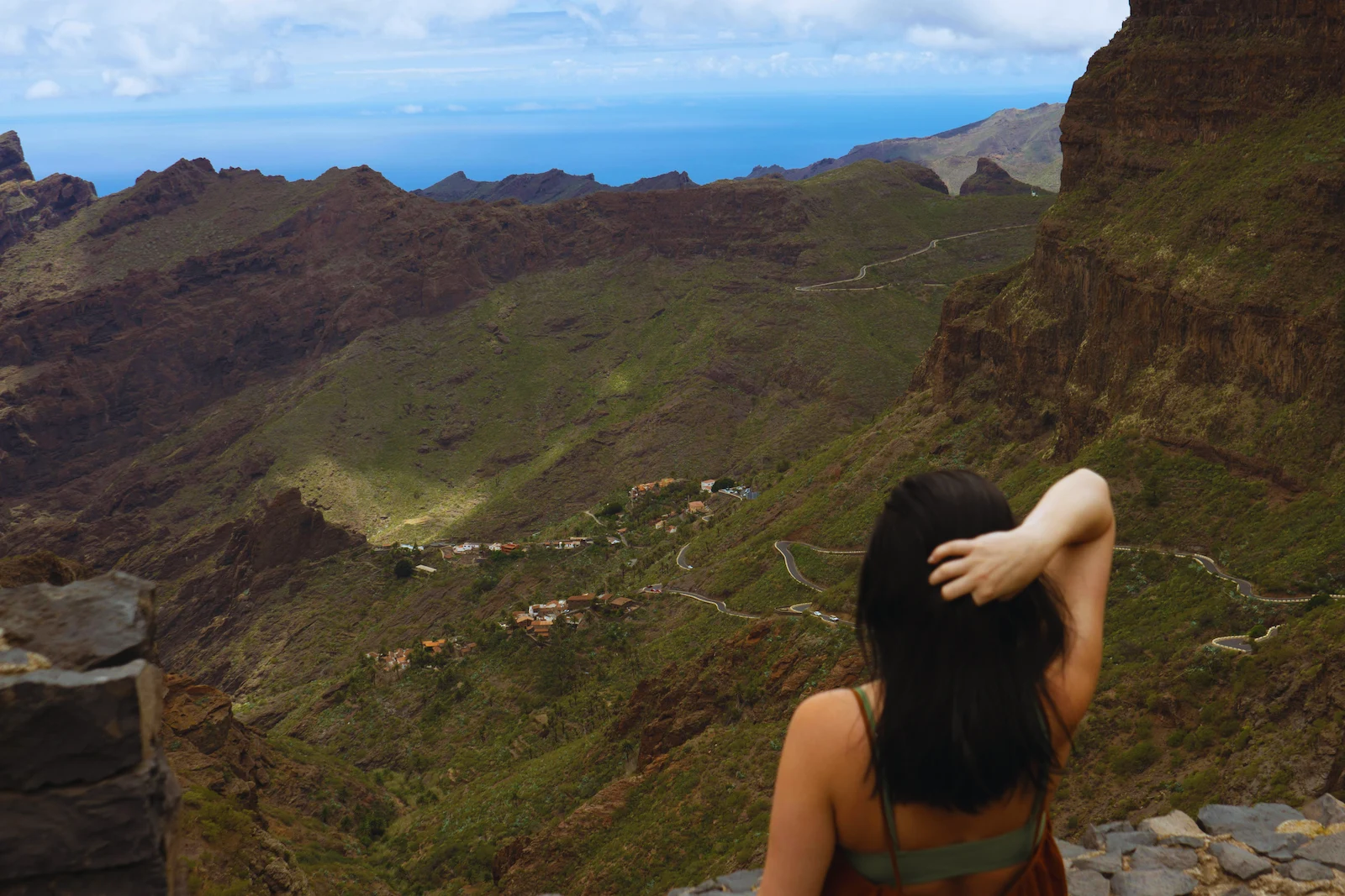
Pico Verde (optional detour) – A short but steep climb from the col leads you to Pico Verde (1318 meters). Here you get a top-down view over the Masca Valley and the winding TF-436 road. It’s one of the best panoramic spots on the trail.
-
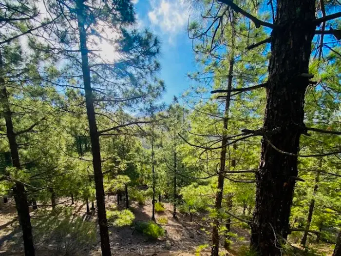
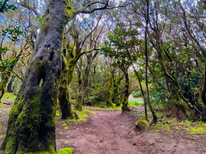
Laurisilva Forest – After the ridge, the trail gently descends into an ancient laurel forest. It’s cooler, greener, and feels almost like walking into another world.
-
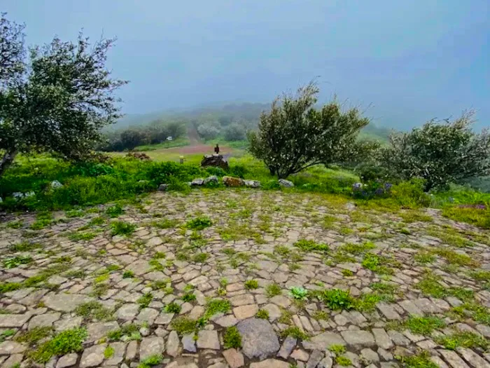
Eira (traditional stone circle) – Along the way, you’ll find a preserved eira, once used by local farmers for threshing grain or preparing food for animals. These old stone structures are part of the cultural history of the Teno region.
-
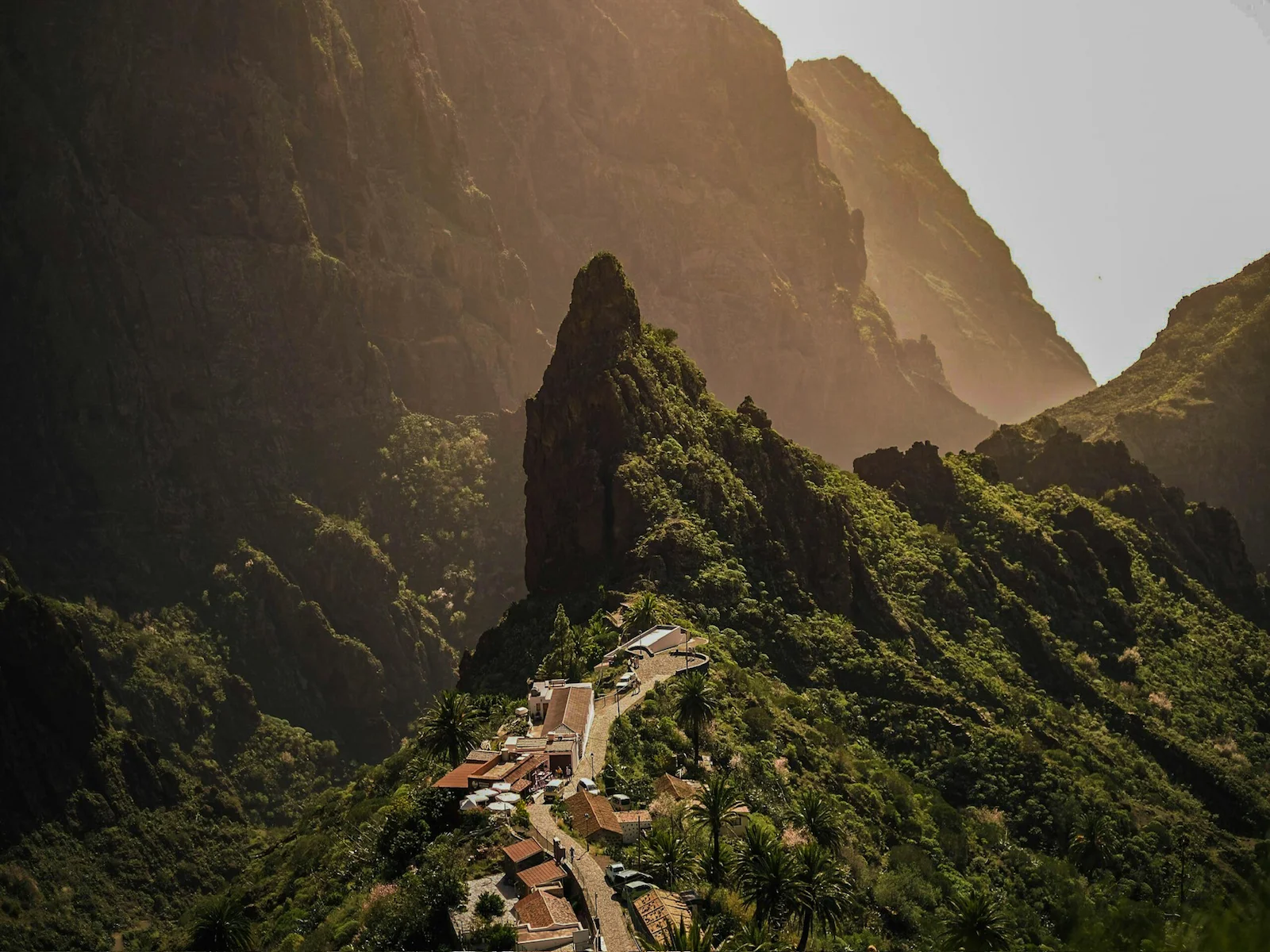
Mirador de Cruz de Hilda – A scenic viewpoint with views across the deep ravines and mountains around Masca. There’s a small café where you can rest and enjoy a drink before the final descent.
-
Masca Village – The trail finishes in the tiny Masca Village, famous for its remote location, steep cliffs, and traditional Canarian houses. It’s a perfect end point where you can relax and have a meal.
Information
The trail starts at coordinates: 28.304312, -16.814998. Look for a right-hand bend in the road, where the trail veers left and climbs into the mountains.
This trail finishes in Masca village.
If you want to continue down the Barranco de Masca (Masca Gorge) all the way to the ocean, you need a separate booking. Entry is controlled, and you must book in advance through the official website: Book the Masca Gorge hike here.
Return: From Masca Village check the Linea 355 timetable in advance.
At the beginning in Santiago del Teide, you climb almost 400 meters up to Degollada de la Mesa, a col between Big Gala and Little Gala (Pico Verde).
You can take a short detour here to climb Pico Verde (1318 m). It’s a quick and rewarding side trip — offering top-down views of Masca and the twisting TF-436 road.
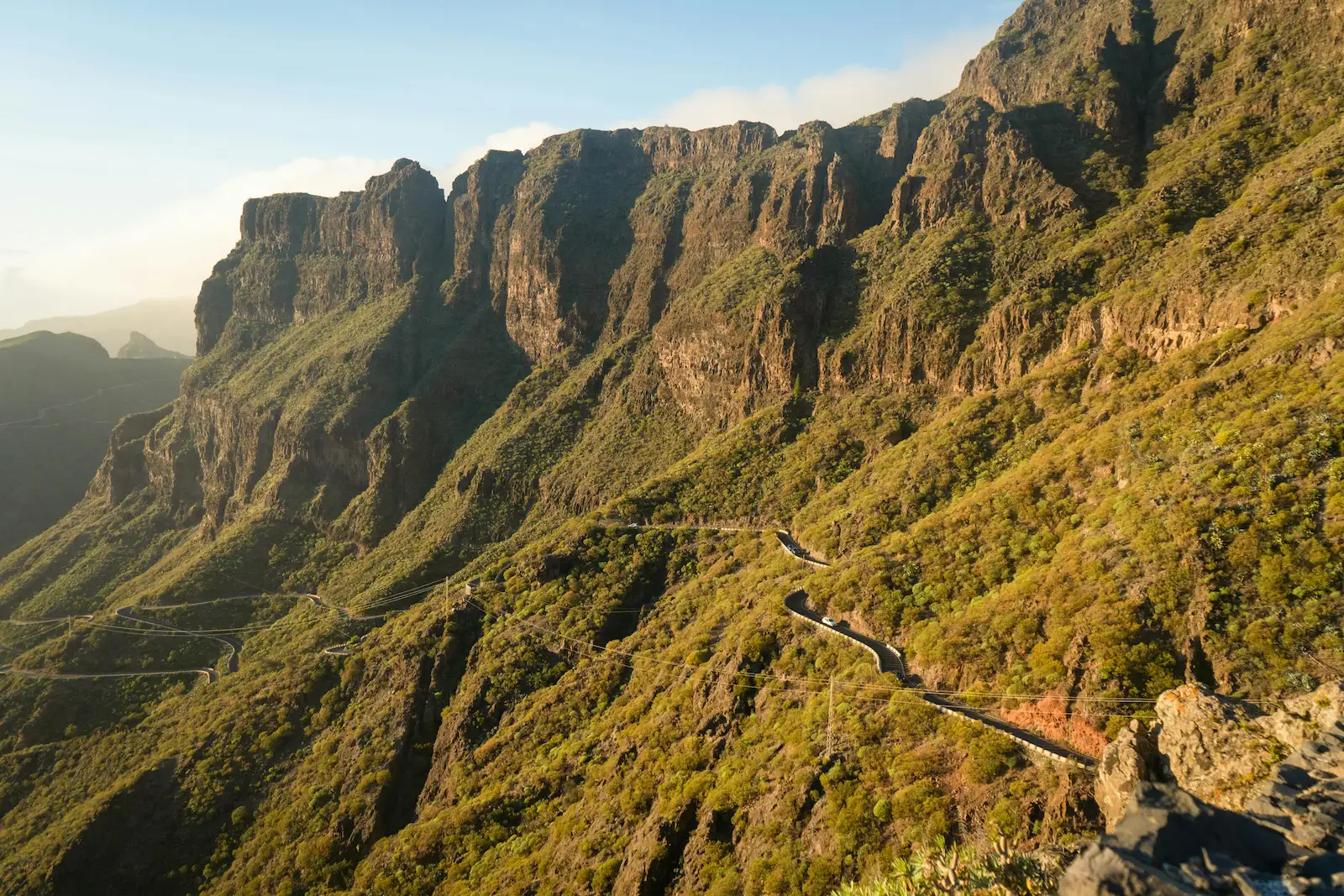
After returning to the col, the trail follows the marked PR-TF 51. It moves along a scenic ridge and then descends into laurel forest, heading towards the intersection with PR-TF 59.
Along the way, you’ll come across an old eira. This rocky circular construction was once used by farmers for threshing grain or preparing feed for animals. It’s a piece of rural history that reminds you how people adapted to mountain life.
At the intersection, turn left onto PR-TF 59 and descend to Mirador de Cruz de Hilda. It’s a peaceful spot to rest, enjoy the mountain views, and even grab a drink at the café.
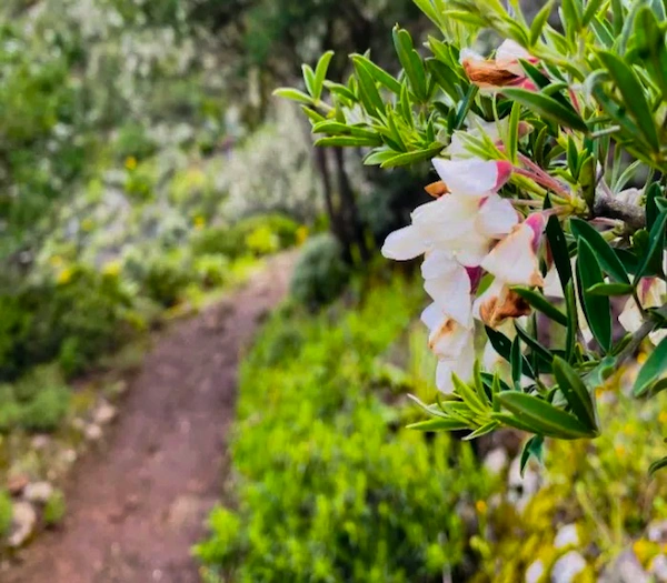
From the Mirador, continue down following the narrow PR-TF 59 road to the hamlet of El Turrón. You’ll pass terraced fields, palm trees, and peaceful farmsteads. After El Turrón, carefully follow the TF-436 road downhill into Masca village.
In Masca Village, there are a few places to eat.
Alternative Routes
This hike can also start from El Palmar. But ending in Masca makes the return easier, because the Titsa Linea 355 bus goes straight back to Santiago del Teide.
How to Get Here
By car: Drive to Santiago del Teide via the TF-82 road. Park at Merendero Santiago del Teide next to the main road. From there, walk about 5 minutes along the TF-82 towards the trailhead (coordinates: 28.304312, -16.814998).
By bus: TITSA Line 460 connects Santiago del Teide with Costa Adeje and Los Cristianos. Line 325 runs from Puerto de la Cruz to Santiago del Teide.
Return: From Masca check the Linea 355 timetable in advance.
Discover Places Nearby


All the best places in one map – beaches, hikes, food, ocean pools, viewpoints, towns and more.
Save hours of searching and plan your trip in minutes.